
Finding Town of Rotterdam Streets by Address
A Town of Rotterdam street directory search is a chain of records, not a single household roster. PROS can show a parcel's situs address, owner field, assessment data, and SBL. SearchIQS then associates recorded document parties with a date and instrument. The map tools add location context, while reverse directories and census sources may help establish a dated historical household. An owner record is evidence of an ownership relationship. It does not prove that the owner, a renter, or every household member occupies the parcel.
Use the physical parcel address as the starting key. Note the town's road name exactly, then save the SBL before moving to the deed or map layer. The SBL is especially useful when an old record uses a hamlet, route, rural address, or alternate postal city.
- Enter the address or road in PROS and save the full situs address and SBL.
- Use Street Finder to review the road's parcel sequence when spelling permits it.
- Open the County Clerk land-record route and search the known owner or deed party.
- Confirm map context in Beacon or SIMS, then ask county staff if a feature is unclear.
- Use a dated directory street section or census only for the historical household question.
Town of Rotterdam Street Finder in PROS
The PROS quick-search form gives this street directory its most direct road-level tool. Street Address accepts partial text, with the suffix omitted. Street Finder is a dropdown of public roads and can be paired with a number. Its result can return every address on the selected road. A search by owner name can include current or prior owners, while an equals sign before the surname requests an exact surname match. These are parcel-search controls, not evidence that an owner currently lives at the property.
| Field | Observed form rule | Street directory use |
|---|---|---|
| Street Address | Partial address, no suffix | Locate one parcel |
| Street Finder | Public-road dropdown, optional number | Review addresses on a road |
| Tax Map / SBL | Parcel identifier | Keep the same land unit across records |
| Owner Name | Last, First; prior owner may appear | Move from a deed party to parcel history |
The advanced PROS form exposes Rotterdam street names, neighborhood codes, sale ranges, property class, and physical-feature filters.
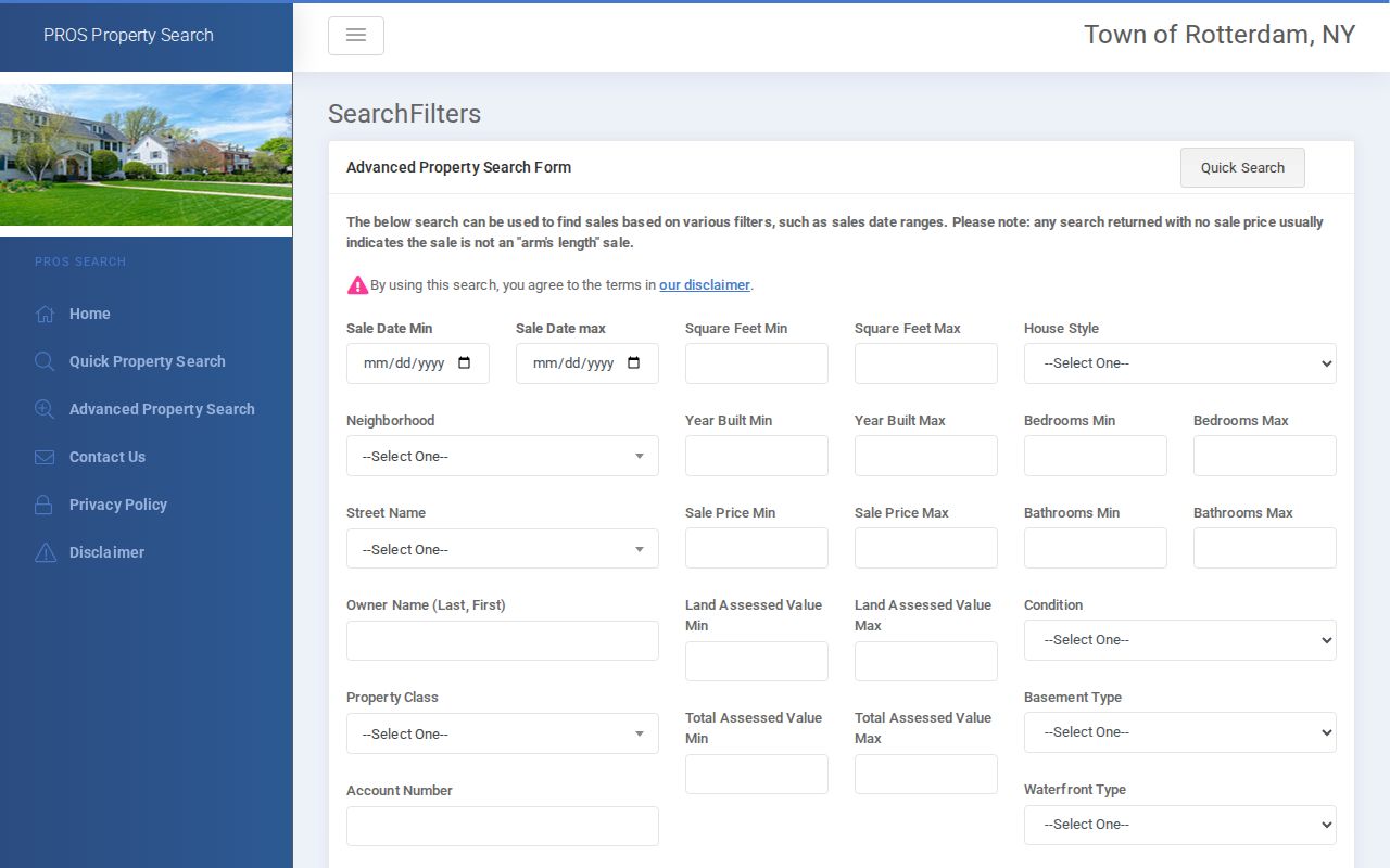
Use an advanced filter to narrow property research, then preserve the result's SBL and assessment year before searching a different record system.
Town of Rotterdam Situs and Mailing Addresses
The property location, called the situs address, is where the parcel is physically located. An owner mailing address can be in another ZIP Code or municipality. A tax bill or deed may show a mailing address, but it should not replace the situs in a street directory note. Record both fields and use the SBL to test whether the sources point to the same parcel. This matters in Rotterdam because postal labels, hamlets, and rural-road patterns can complicate an apparently simple address match.
- Parcel
- A defined piece of land in an assessment or tax-map system.
- Situs address
- The physical location assigned to a parcel.
- Plat or tax map
- A map document that depicts parcels or lots, not a title opinion.
- Criss-cross directory
- An address-to-name listing, often called a reverse directory or street section.
Town of Rotterdam GIS Street Context
The County tax-map page links to Beacon and local assessor resources. It cautions that its tax-map information comes from multiple sources and carries accuracy disclaimers. The public SIMS Lite viewer sits within a countywide GIS system used by County offices, E-911, elections, public health, real property, emergency management, agriculture, and watershed programs. County materials also describe historic and current aerial photographs and maps.
The live research pass did not capture exact Beacon or SIMS search controls. Use PROS for the initial parcel lookup. Use Beacon, SIMS, or county staff to confirm road, map, and adjacent-parcel context. Do not describe an unmapped viewer feature as available until it is visible in the live tool.
The County tax-map page says its PDFs can be viewed but not printed from that page. That limitation is another reason to keep the official parcel number, road name, and access date in research notes. A map can help distinguish adjacent land, yet only a recorded instrument and the proper custodian answer a deed or title question. Map boundaries are useful context, never final legal proof.
Town of Rotterdam Street Directory Records
Each Town of Rotterdam street directory source has a different role. The assessment system identifies an owner field and parcel facts. The map systems place that parcel among roads and nearby SBLs. The County Clerk identifies parties to recorded deeds and other instruments. Town permit records can identify an owner, applicant, property address, and tax map number, but no public permit-index search or digitized start year was located. A targeted request through the Town Clerk or DPW is the documented fallback for an address or SBL question.
| Record Set | Keeper | What It Shows | Access |
|---|---|---|---|
| PROS assessment roll | Town Assessor | Situs, owner field, assessment, SBL, inventory | Public portal and Town Hall computer |
| Beacon and SIMS context | County Real Property / GIS | Tax map, map layers, road and parcel setting | County links and staff confirmation |
| Recorded land instruments | Schenectady County Clerk | Grantor, grantee, recording date, legal description | SearchIQS and Clerk counter |
| Voter record request path | Board of Elections / State | Lawful election record information | Limited lookup and supervised request rules |
| Permit applications | Town DPW / Building Inspection | Address, owner, tax map, applicant information | Request by address or SBL |
Use the parcel number to connect the roll, deed question, and permit request. Use the street name as a search aid, not as proof that all returns share a single household. The state voter lookup is not a general street browser, and confidential voter rules still apply.
Town of Rotterdam Street Deed Chain
After PROS identifies a parcel and owner field, the County Clerk's land-record route supplies the recorded-document step. SearchIQS supports Party 1 and Party 2 searches, optional date fields, partial names, wildcard asterisks, sortable results, related-document links, and image viewing when an asterisk appears by View. A date range can use short numeric formats such as 1/9/21 or 01092021. Its public guide says red text marks an unverified document or date.
Follow the grantee named on a newer deed back to the prior grantor, then repeat the name and date search. An online cutoff has not been published, so an older gap belongs at the Clerk counter, library, historical society, or a focused records request. The address alone is not enough, because a street can contain many parcels and an instrument may use a legal description instead.
Schenectady County Record Alert lets a person enroll a name for recording notifications.
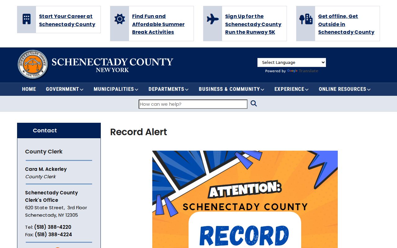
Record Alert is a notice tool, not a title search, and it does not determine whether a filing is fraudulent.
Town of Rotterdam Street Sections After 1930
Historical work by address turns to the Schenectady County Public Library's directories and the Grems-Doolittle house-history guide. The guide says city directories begin to include street-address sections in 1930. Those sections are the most direct historical street directory tool because they work from address to name. The SCPL run is not a Rotterdam-only series and has gaps, so inspect the specific volume before assuming that it covers a town road or year.
The historic route is address or SBL, then a selected directory volume, then a census, deed, obituary, or cemetery record to test the match. For the full directory collection and its year-by-year gaps, use the Directory Book. That keeps this street directory focused on the address-keyed chain rather than duplicating the historical shelf.
Town of Rotterdam Street Directory Limits
A Town of Rotterdam street directory can connect an address with public parcel, deed, map, and dated directory material. It cannot establish every person in a home. Owner records leave out many renters and other household members. A property mailing address can differ from the physical site. New York's voter protections, the Address Confidentiality Program, and restricted identifiers set firm limits. Utility and delivery data are not a public street list, and a voter result should not be copied into a contact list.
For an official record that is not online, make a narrow request to the record custodian. Identify the address or SBL, date span, and record type. FOIL applies to existing agency records, but courts use their own access rules under Judiciary Law § 255. Ask the office about current access, redaction, and copy procedures rather than assuming that an address makes every associated file open.
Lawful use. Use Town of Rotterdam address records for personal, lawful research, property history, estate questions, or civic transparency. Never use them to stalk, harass, intimidate, or harm another person.
Town of Rotterdam Address Permit Trail
The Town Department of Public Works combines Building Inspection, Code Enforcement, Planning and Zoning, and GIS or location functions. A reviewed sign-permit form asks for a property address, owner name and address, tax map number, applicant, contractor, contact details, and work information. A permit can show that an owner or applicant interacted with the department at a stated time. It is not proof of occupancy or a substitute for a deed.
No public permit-index fields, digitized start year, or code-case search was located during research. For a specific road address, ask the Town Clerk or DPW for the available permit index and inspection or code record by address or SBL. The department lists GIS or Maps or Location at ext. 364, Planning and Zoning at ext. 338, and Building Inspection contacts at ext. 362 and 356.
Town of Rotterdam Road and Postal Clues
Road research can also run into postal geography. Town records and the fire-district inventory point to Rotterdam, Rotterdam Junction, Pattersonville, and Schenectady postal labels. A ZIP Code or post-office city helps route mail, but it does not define a municipal boundary or replace the assessed situs. Use the SBL and the town or county map to settle the parcel location. The ZIP Codes has the postal-area detail for this part of the search.
For an older address, compare the street name, SBL, map, directory street section, and neighboring parcels. Rotterdam's eCode includes a chapter on street naming and numbering, yet the research did not find a complete official historical renumbering crosswalk. That gap should stay visible rather than being filled with a guessed address conversion.
Rotterdam Junction has a separate historical map clue in the 1913 Sanborn sheet held through local-history collections. It can show a structure's footprint and construction context at that time, not a complete household list. Pair a map observation with the directory volume, census, deed, or probate record that supplies a name and date. The 1856 county map, 1866 county atlas, and 1870-80 VB 79 address-indexed ledger offer more place links when the modern road description is not enough.